The goal of this research is to develop a general deep learning solution for atmospheric correction and target detection using multiple hyperspectral scenes. Several hundred thousand hyperspectral simulations were performed using the MODTRAN software, which were used both to train the deep learning solution, as well as validating the proposed method.
The deep learning solution is based on convolutional neural networks, and it learns relationships between the total radiance observed at the sensor, and the atmospheric components of upwelling, downwelling and transmission. This research focuses on emissive properties of targets, and simulations are performed in the longwave infrared. Results show that the proposed method is computationally efficient, and it can characterize the atmosphere and retrieve the target spectral emissivity within one order of magnitude errors or less when compared to the original MODTRAN simulations.
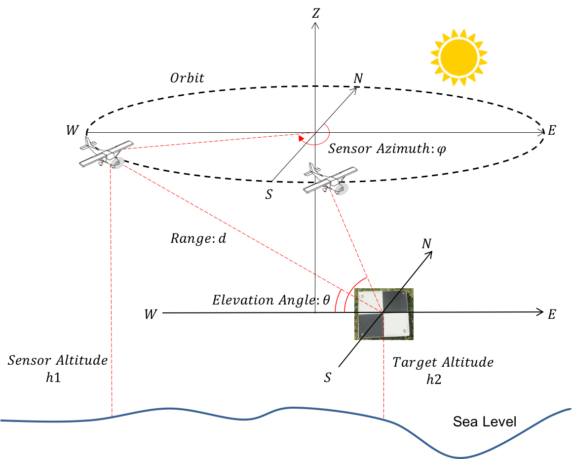
Multiscan Geomtric Setting
Nittany Radiance is a project supported by DARPA for data collection that aims to better classify and characterize objects using hyper-spectral longwave remote sensing.
Single data collection is on the afternoon of Wednesday April 18. The plane with Blue Heron sensor flew from Rochester International Airport (ROC) and collected over State College with 2 miles radius orbit and 0.5 m geometric standard deviation
Article in Penn State News about the NittanyRadiance2019.
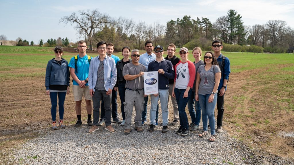
Nittany Radiance Participants
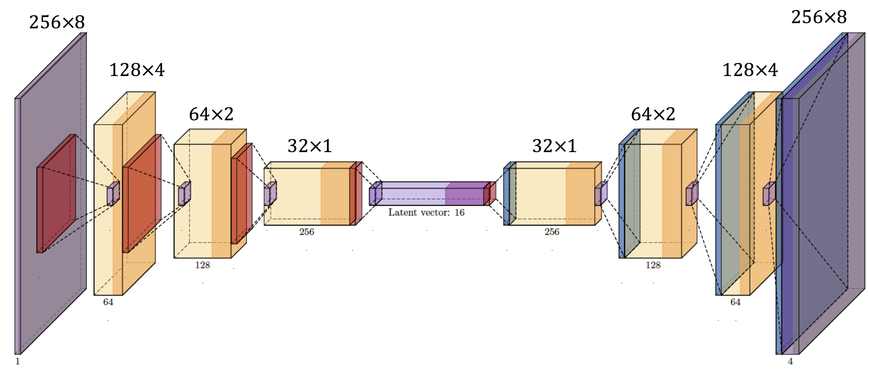
The trained network, python codes and data examples can be downloaded here. This is for our current submission to the Journal of of Applied Remote Sensing, which is authored by Xu, Cervone, Franch, and Salvador. Install the pytorch library before using the python code in the zipped file to reproduce our results. If you have any questions about our work, contact us via xfangcao AT psu DOT edu or cervone AT psu DOT edu.
Usage: python predict.py --input totalRadiance.csv --model ae_latest_down.tar --output Downwelling.csv
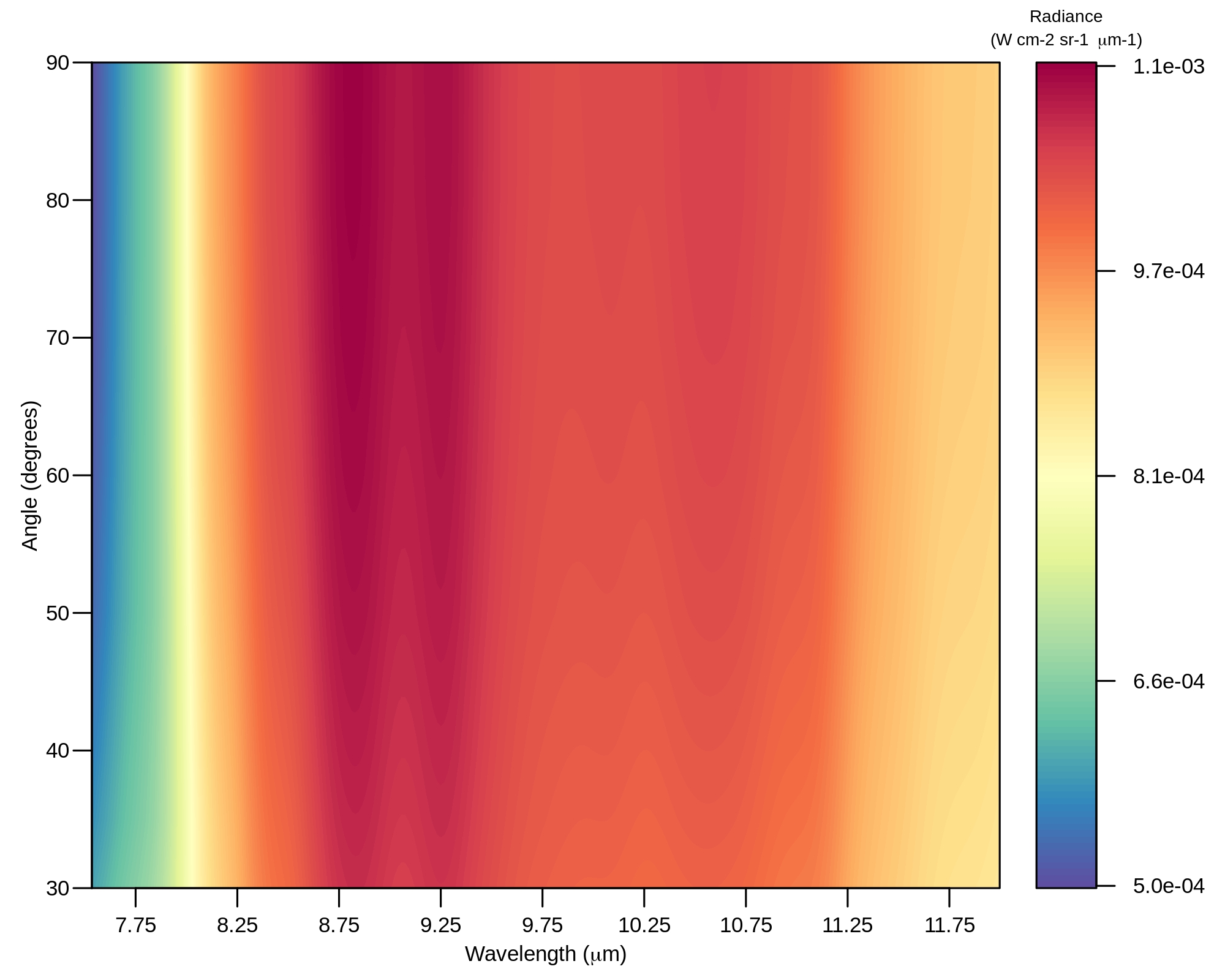
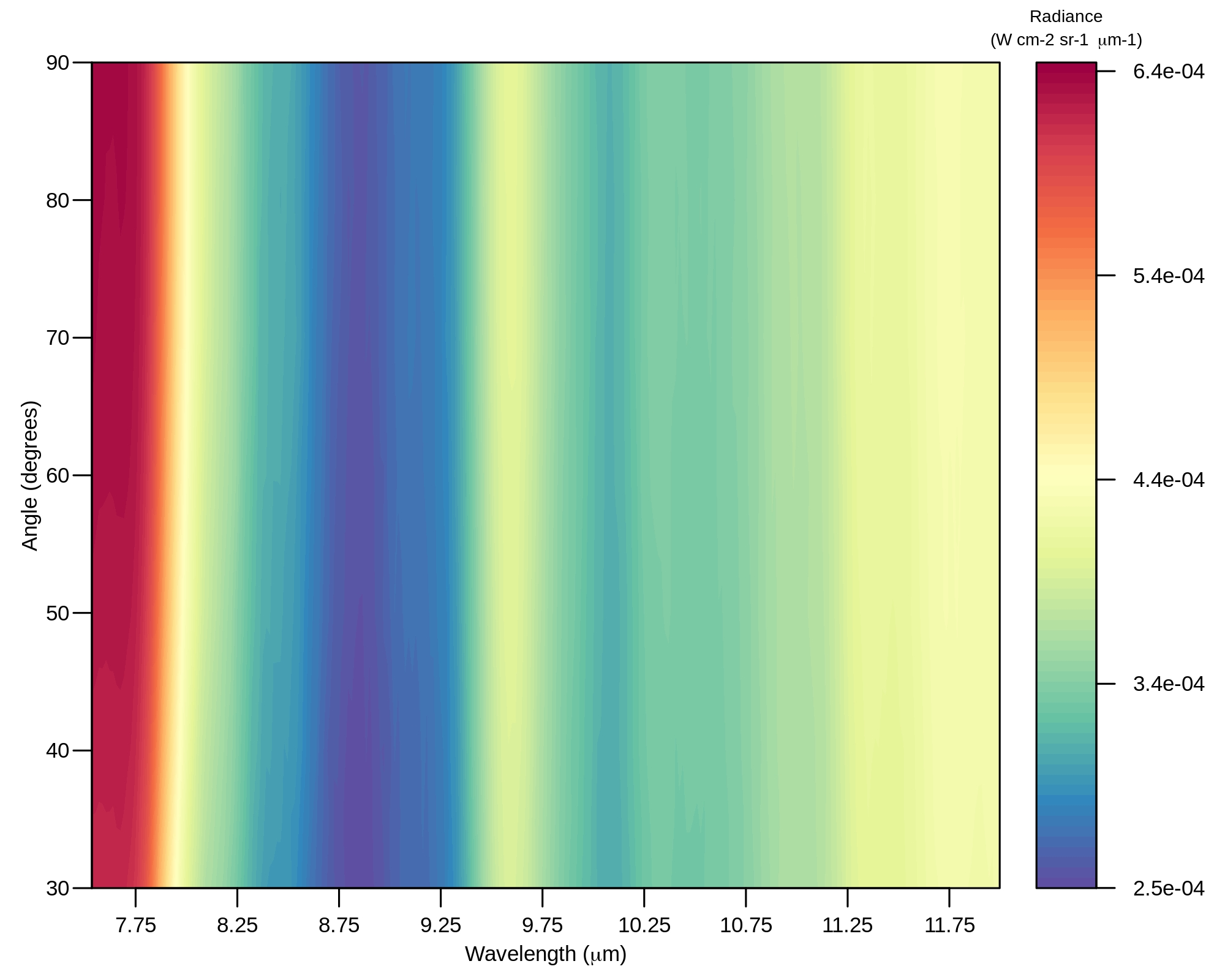
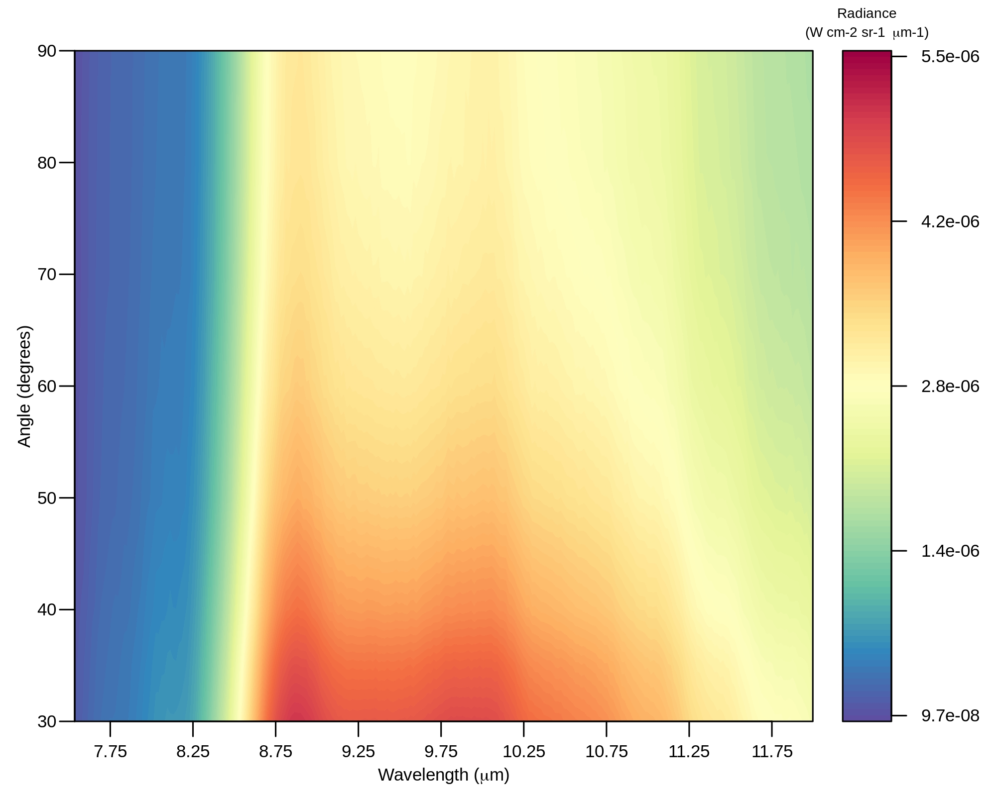
Total Radiance Received at the Sensor
![]()
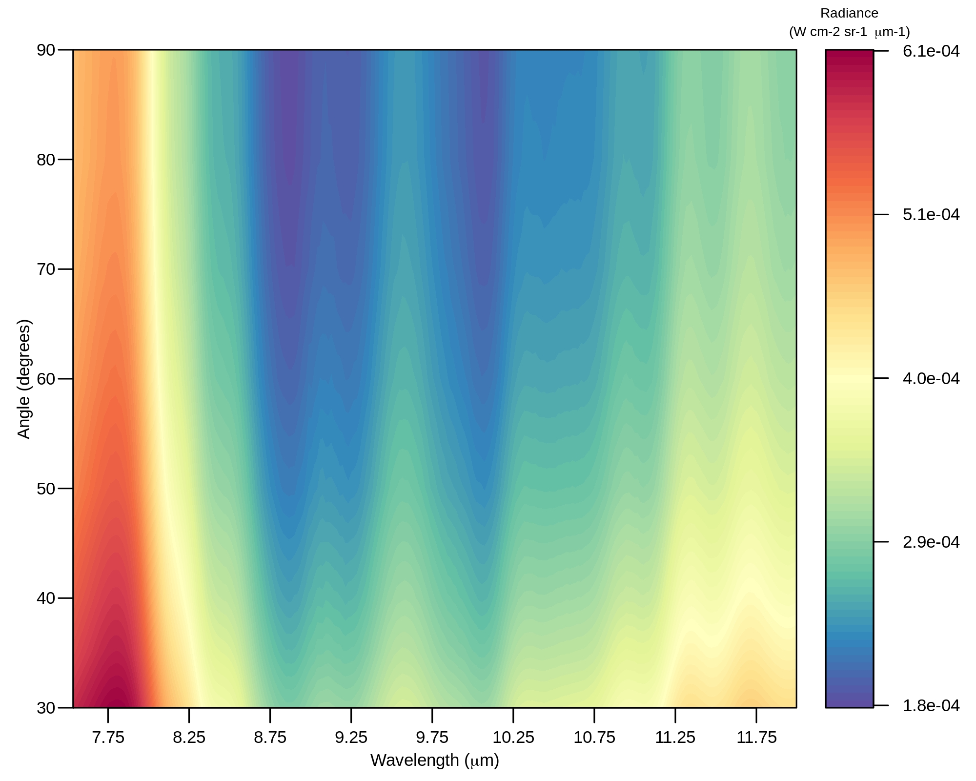
Predicted Downwelling Radiance
![]()
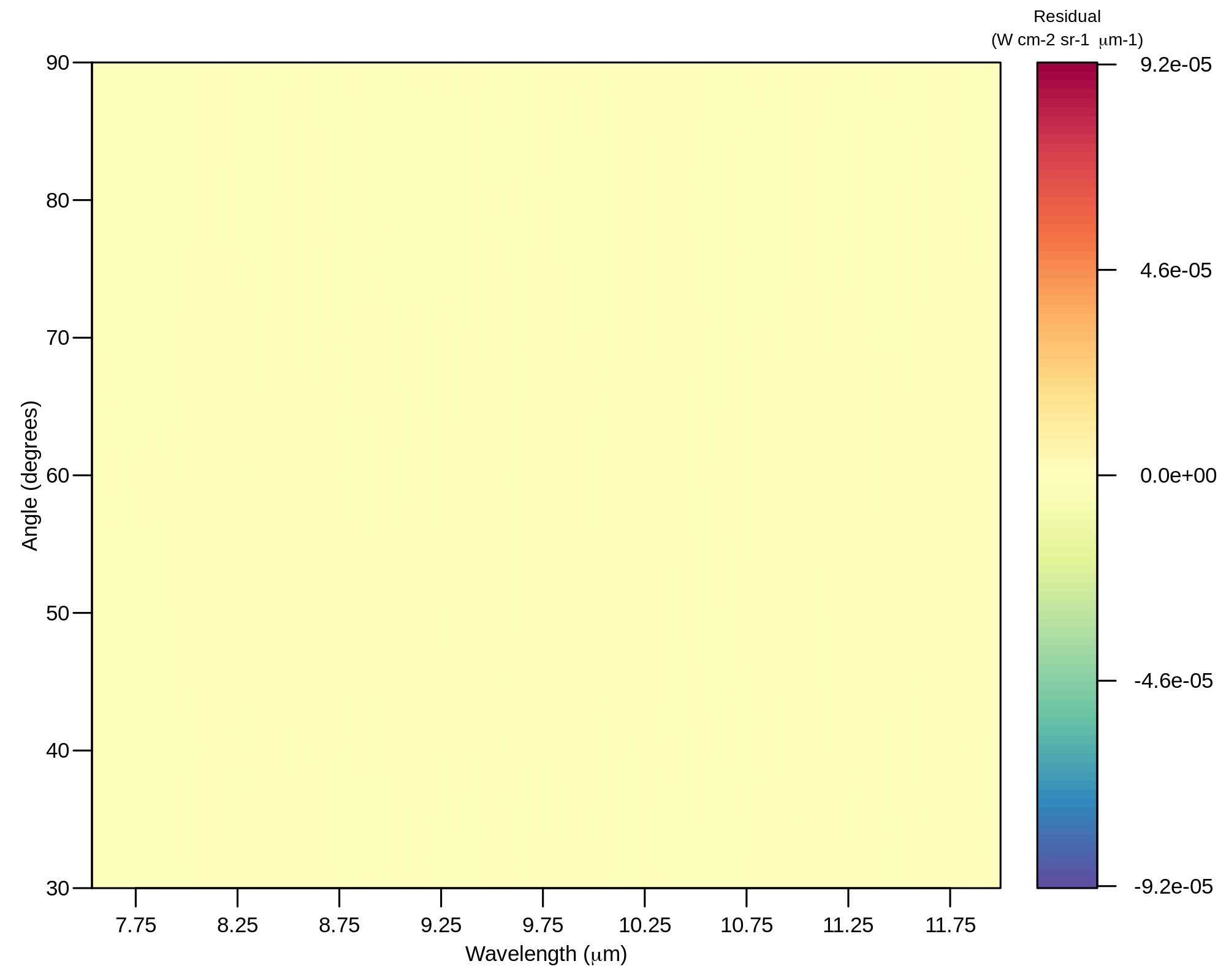
Residual of Downwelling Radiance
Predicted Downwelling Radiance
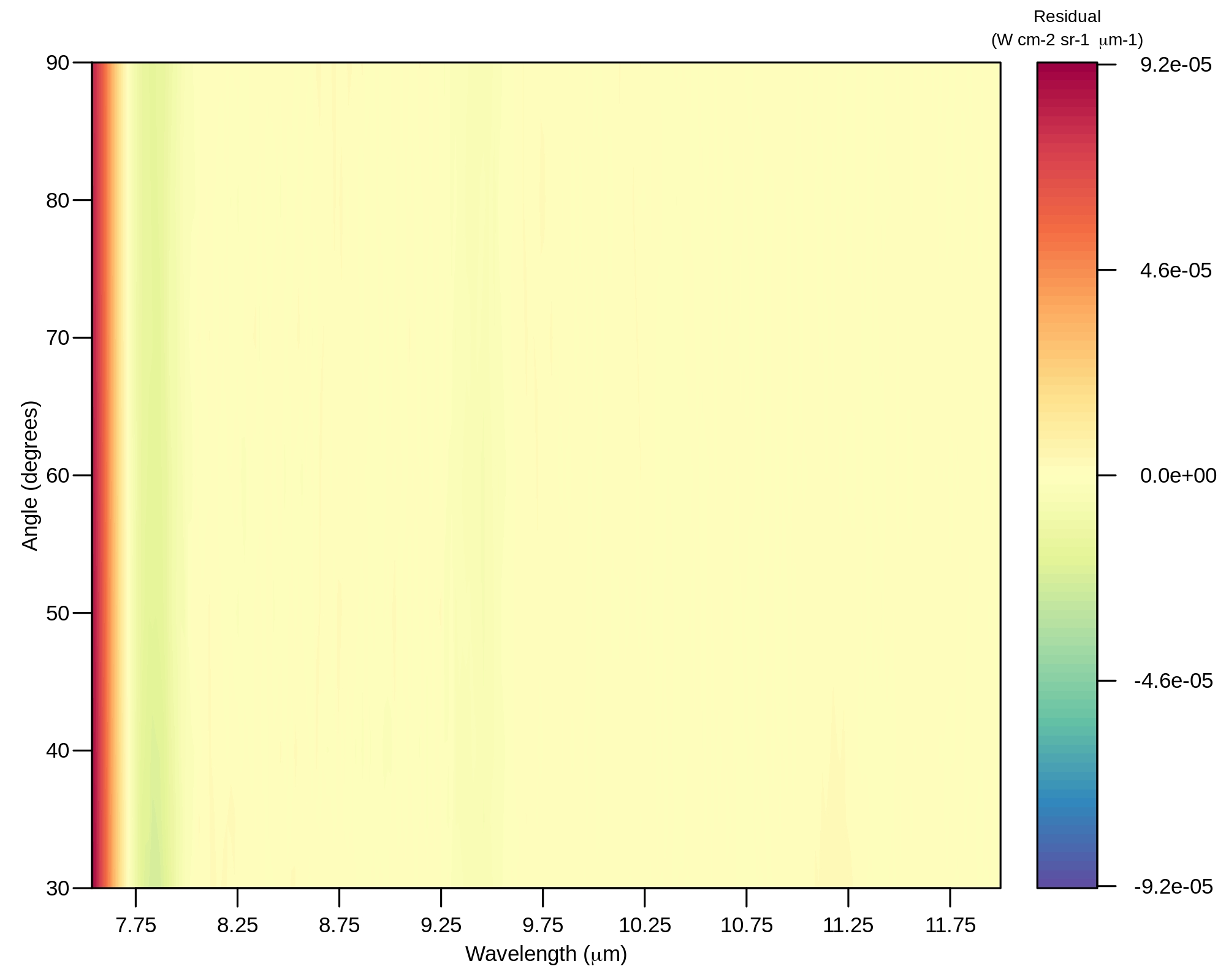
Residual of Downwelling Radiance
Predicted Path Thermal Emission Radiance
Residual of Path Thermal Emission Radiance
Predicted Path Thermal Scattering Radiance

Residual of Path Thermal Scattering Radiance
This research presents an Artificial Intelligence/Deep Learning (AI/DL) based solution to characterize the atmosphere at different vantage points and retrieve target spectral properties. The results shows that this proposed approach could: 1) estimate atmospheric components of upwelling, downwelling and transmission as a function of angles, given as input the at-sensor total radiance, within one order of magnitude errors or less when compared to MODTRAN solutions for the longwave infrared spectrum; 2) retrieve the target spectral properties; and 3) give an estimate of the error for the retrieved target spectra.